
Garmin eTrex SE
4.2Editor score
Up to 168 hours battery
Multi-GNSS satellite support
Water-resistant IPX7 design
Finding the right navigation tool is essential for anyone planning to hike the Pacific Crest Trail. A reliable GPS ensures you stay on course through remote sections where cell service is nonexistent.
We analyzed ten top-rated handheld GPS units based on satellite accuracy, battery endurance, map quality, and durability. Each device was selected for its ability to handle rugged terrain and extended trips.
Every pick includes detailed specs, pros, cons, and real-world usage insights. Keep in mind that pricing fluctuates often, so verify current costs before making your final purchasing decision.
4.2Editor score

4.6Editor score

4.6Editor score
As an Amazon Associate we earn from qualifying purchases.
Below is a side-by-side comparison of all ten recommended GPS units. Review the key specifications to find the model that best fits your hiking style and budget needs.





The Garmin GPSMAP 65s stands out as the top choice for hikers needing reliable navigation on the Pct. It holds an impressive 4.6 rating from users who appreciate its robust build and precise tracking capabilities.
We may earn a commission when you buy through this link, at no additional cost to you.
Its multi-band technology ensures you maintain signal even under dense tree cover or near steep canyons, which is critical for long-distance trails. The 2.6-inch color display is bright and easy to read without sunglasses.
While the button interface is slightly less intuitive than touchscreens, it offers better control when wearing gloves or in wet conditions. The learning curve is minimal compared to the reliability it provides.
If you want a device that balances advanced features with durability, this is the unit to buy. It simplifies route planning and keeps you confident on the trail.
The multi-band GNSS support allows the device to filter out signal interference, providing a consistent lock in challenging environments.
Syncing with the Garmin Explore app lets you manage tracks and waypoints seamlessly across your smartphone and handheld unit.
We may earn a commission when you buy through this link, at no additional cost to you.
For hikers who prioritize safety and communication, the Garmin GPSMAP 67i is the premium choice. It combines robust navigation with inReach satellite technology, earning a strong 4.6 rating from adventurers.
We may earn a commission when you buy through this link, at no additional cost to you.
You can send messages, share location, and trigger an SOS via the Iridium network, ensuring help is accessible even in remote sections of the Pct. This peace of mind is invaluable for solo travelers.
The subscription requirement adds an ongoing cost, and the unit is pricier than basic models. However, the ability to stay connected without cellular service often justifies the investment for long hikes.
Buy this if you need reliable off-grid communication alongside accurate navigation. It transforms your handheld into a lifeline for emergency situations on the trail.
The Iridium network covers 100 percent of the globe, allowing for two-way texting anywhere you roam without cell towers.
In expedition mode, the internal battery lasts over 400 hours, ensuring the device remains active through multi-day trips.
We may earn a commission when you buy through this link, at no additional cost to you.
The Garmin eTrex SE offers the best value for hikers seeking essential navigation without breaking the bank. It holds a 4.2 rating for its simplicity and long battery performance in standard mode.
We may earn a commission when you buy through this link, at no additional cost to you.
With up to 168 hours of battery life, you can trek for weeks on a single charge or spare AA batteries. This makes it ideal for those prioritizing weight and longevity over advanced maps.
The screen is smaller and the interface feels dated compared to newer models, but the core GPS functionality remains solid and reliable. It gets the job done without unnecessary complexity.
Choose this if you want a lightweight, budget-friendly navigator for the Pct. It is perfect for beginners or anyone who prefers carrying spare batteries over recharging.
Switching to expedition mode can extend battery life to 1,800 hours, allowing for months of tracking during long expeditions.
The button controls are straightforward, making it easy to mark waypoints or view your location without needing a manual.
We may earn a commission when you buy through this link, at no additional cost to you.
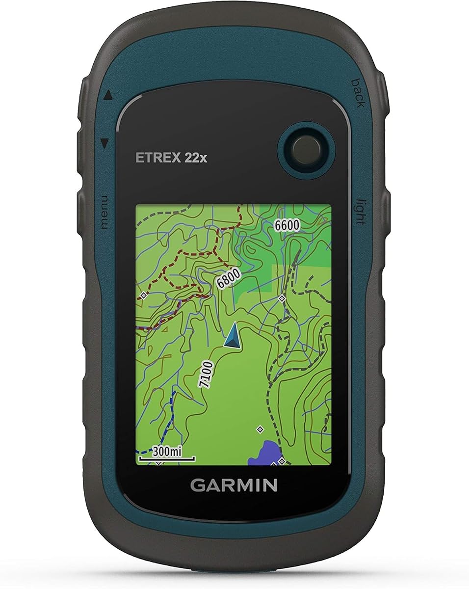
The Garmin eTrex 22x is a classic handheld designed for simplicity and reliability. It has a 4.3 rating thanks to its solid performance and compact form factor that fits easily in a pack.
We may earn a commission when you buy through this link, at no additional cost to you.
It comes preloaded with TopoActive maps, allowing you to start navigating immediately without extra setup. The GLONASS support helps improve acquisition speed in difficult terrain.
Battery life is limited to 25 hours, which may require frequent recharging on very long hikes. However, the included micro SD slot lets you expand storage for more detailed maps.
This unit is best for those who want a no-fuss navigator that just works. It delivers core functionality without the complexity of touchscreens or heavy software.
Adding a micro SD card allows you to download custom maps and waypoints, expanding the device beyond its internal 8 GB memory.
The sunlight-readable color display ensures you can read maps clearly even in the brightest outdoor conditions.
We may earn a commission when you buy through this link, at no additional cost to you.
This handheld GPS offers a large 3.2-inch screen that is easy to read even in bright sunlight. It has a 3.9 rating, reflecting a mix of user experiences regarding consistency and build quality.
We may earn a commission when you buy through this link, at no additional cost to you.
With 36 hours of battery life and a rechargeable battery, it is a convenient option for extended trips. The preloaded USA Topo maps provide immediate value for hikers on domestic trails.
While the hardware is capable, user feedback suggests some variability in unit quality. It may not match the precision of top-tier brands in extreme conditions.
If you need a large screen and USB-C charging at a budget price, consider this model. It is suitable for day hikes or shorter sections of the trail.
The larger display area makes it easier to view detailed trails and waypoints without squinting or zooming too much.
Using a standard USB-C cable means you can charge the device with the same cable used for many modern smartphones.
We may earn a commission when you buy through this link, at no additional cost to you.
The Garmin eTrex 32x builds on the eTrex platform with a 3-axis compass and barometric altimeter. It has a 4.2 rating for being a reliable companion for trail navigation and elevation tracking.
We may earn a commission when you buy through this link, at no additional cost to you.
It comes with TopoActive maps and supports both GPS and GLONASS. The 32x adds an altimeter to help you monitor elevation changes accurately along the Pct.
The screen remains small at 2.2 inches, which can make reading detailed maps difficult in a rush. However, the physical buttons ensure operation even with gloves.
This unit is ideal for hikers who want altitude tracking without a premium price. It delivers core navigation features in a proven, durable design.
The barometric altimeter measures air pressure to provide precise elevation data, useful for assessing climb difficulty.
Preloaded TopoActive maps cover many trail networks, offering a solid starting point for planning your route.
We may earn a commission when you buy through this link, at no additional cost to you.
The S190 Handheld GPS has received perfect 5.0 ratings from users who value its large screen and ample storage. It offers a 3.2-inch display that is bright and easy to navigate.
We may earn a commission when you buy through this link, at no additional cost to you.
It supports GPS, BeiDou, Galileo, and QZSS satellites to improve positional accuracy. With 64 GB of internal memory, you have plenty of room for detailed maps.
Some users report issues with map zoom levels depending on the region. You may need to download additional files to get the best detail on specific sections of the trail.
For a budget-friendly device with a large interface and lots of memory, this is a strong contender. Just be sure to check map coverage before heading out.
Supporting four different satellite networks increases the chances of maintaining a strong lock even in deep canyons.
The generous 64 GB capacity allows you to store multiple map sets without needing an external SD card.
We may earn a commission when you buy through this link, at no additional cost to you.
The Garmin eTrex 10 is a no-frills device designed for simple navigation. It has a 4.3 rating from users who prioritize a lightweight form factor and basic functionality.
We may earn a commission when you buy through this link, at no additional cost to you.
It comes with a worldwide basemap, making it versatile for travel beyond the Pct. The WAAS-enabled receiver ensures quick positioning when you first turn it on.
The monochrome screen is readable but lacks the detail of color displays. If you need to view terrain contours or shaded relief, this might feel limiting.
Choose this if you want the simplest, lightest GPS possible. It is great for those who do not need advanced mapping features or color visualization.
The worldwide basemap provides basic route data for hiking anywhere on the globe without needing to load custom maps.
Rated IPX7 waterproof, the unit can withstand splashes and rain, ensuring it remains functional in wet weather.
We may earn a commission when you buy through this link, at no additional cost to you.
The Garmin GPSMAP 61i Plus combines a 3.5-inch touchscreen with inReach Plus satellite technology. It has a 5.0 rating from early adopters who appreciate its premium features and connectivity.
We may earn a commission when you buy through this link, at no additional cost to you.
You can send photos and voice messages via satellite, keeping loved ones updated without cellular service. The MIL-STD 810 certification ensures it can handle tough outdoor conditions.
The price is very high and requires a subscription. It is a significant investment, but the ability to share voice and photos adds a new dimension to backcountry travel.
This is the ultimate choice for high-end hikers who want the best tech. It delivers safety and luxury features that few other devices match.
The sunlight-readable touchscreen makes zooming and swiping through maps easier than with buttons alone.
Sending photos via satellite lets you share scenic views from the trail even when you are out of cell range.
We may earn a commission when you buy through this link, at no additional cost to you.
The Garmin GPSMAP 66i offers satellite communication and robust mapping in a reliable package. It has a 4.5 rating for combining essential safety features with practical navigation tools.
We may earn a commission when you buy through this link, at no additional cost to you.
The 3-inch display is large enough to view maps comfortably. You can download Birdseye satellite imagery directly without an annual subscription, which adds significant value.
As a renewed product, the unit may show minor signs of wear, but it retains the core functionality. This makes it a cost-effective way to access premium satellite messaging.
Select this if you want a proven satellite communicator at a lower price. It remains a dependable choice for staying safe on remote trails.
Downloading Birdseye imagery helps you visualize the terrain around you, aiding in route selection.
The rechargeable battery provides up to 35 hours of tracking in standard mode, ensuring long endurance.
We may earn a commission when you buy through this link, at no additional cost to you.
Selecting the right GPS requires weighing several factors to ensure it matches your specific hiking needs and trail conditions.
Battery endurance is critical for long-distance hikes like the Pct. Look for devices that offer at least 20 to 30 hours on a single charge or AA battery set to avoid frequent recharging.
A clear, sunlight-readable screen is vital for viewing maps during the day. Larger color displays help you see trails and elevation changes more easily than monochrome screens.
Multi-GNSS support ensures you maintain a strong signal under dense tree cover or in canyons. This feature significantly improves accuracy in challenging environments.
Check if the device comes with preloaded topographic maps. The ability to load custom maps expands your options for detailed trail and terrain visualization.
A rugged, waterproof design is necessary to withstand rain, dust, and accidental drops. Look for IPX7 ratings or higher to ensure reliability in any weather.
If you plan to hike remote sections, consider a device with satellite messaging or SOS capabilities. These can be life-saving tools when out of cellular range.
Lightweight devices reduce pack weight, which is important for long trails. Balance the need for features with a form factor that does not become cumbersome over time.
Evaluate whether advanced features justify the cost. Budget-friendly models can perform well, but premium units often offer better accuracy and communication capabilities.
Always charge your device fully before heading out on a long hike. Carry extra AA batteries or a portable power bank if your unit supports rechargeable packs.
Practice using the GPS at home or in your backyard to understand the menus. This prevents confusion on the trail when you need to mark waypoints or check your position.
Keep the device clean and dry. Wipe it with a soft cloth and store it in a protective case when not in use to prevent damage from dust or moisture.
Most basic GPS units do not require a subscription to navigate. However, advanced features like inReach messaging and live weather may need an active plan to function.
While smartphones have GPS apps, their battery life is short and they can be damaged easily. Dedicated units are more reliable for long-duration hiking without power access.
Topographic maps are essential for viewing trails and elevation. Ensure your device supports topo maps so you can see contour lines and terrain details clearly.
Modern devices with GNSS support are highly accurate within a few meters. However, deep canyons or dense forests may reduce signal strength slightly.
A built-in compass helps orient your map and maintain direction even when the signal is lost. It is a reliable backup feature for critical navigation situations.
Yes, some models can be charged via USB ports connected to solar panels. This is a great way to extend battery life during long trips without access to electricity.
Whether you choose the budget-friendly eTrex SE or the premium GPSMAP 61i Plus, reliability is key. These top picks offer the navigation tools needed to explore safely.
Prioritize battery life and display quality to ensure comfort on the trail. A device that lasts long and is easy to read will serve you best during challenging conditions.
Remember to check current pricing and availability before buying. Technology evolves quickly, so verifying the latest model specs ensures you get the most out of your investment.